She wouldn’t walk away. She had been by turns following us and running ahead of us for 6 kilometers. Always close at our heels, or a few paces in front; often looking up at us and grinning in sheer delight over our shared adventure. But she was a small blonde dog, miles away from her home and her puppy, and we were now responsible for her. We thought she should turn back. Still, it would have been impossible to chase her away. She’d run away with our hearts! What could be more delightful than having a canine trekking companion? She was our friend, if only for that one magical morning.

The adventure: a 336k trek around Jeju Island
This was the final morning of our 12 day circumnavigation of Jeju Island. My husband Kent and I were trekking the Jeju Olle, a network of pedestrian paths encircling South Korea’s largest island. Every day we’d been lucky in various ways: we’d had great weather, managed to find inexpensive accommodation and good food, and seen splendid natural beauty. But the highlight of our trek was definitely our daily animal encounters! We’d petted cats, shared apples with horses, met mantises, and had a lovely little dog join us on our last Olle course.

One year earlier, in October 2014, we’d visited friends living on Jeju Island. Together, we walked one of the Olle courses while catching up on life. The route we explored that day was fairly typical of the Olle trails, a 16 kilometer route following scenic coastal roads and rugged trails over volcanic cones. When our friends told us we could walk around the whole island on these footpaths, then and there we vowed to come back and do it!
In October 2015, we were back in Korea, and we immediately hopped on a ferry to Jeju! Upon arrival in Jeju City, our first stop was to pick up the two Jeju Olle passports in which to collect stamps along the way (plus a bonus English guidebook!).


Olle Day-by-day
The following is a day-by-day and route-by-route description of our adventure trekking around Jeju Island.
Day 1: 11.4k – Route 21
The day after we arrived happened to be a volunteer clean-up day on one of the Olle trails! The clean-up was on the final course – #21, but we decided to make it our first. It was exciting to be out on the trail and meeting new people – all passionate and knowledgeable about Jeju Olle. So we spent the first day of our trek walking and talking, and using giant tweezers to pick up trash. And of course, we immediately began mapping our trek and gathering our first stamps!


Although we were off to a great start, the sheer amount of trash we found was a sobering reminder of the state of our planet. At one point, I spent several minutes on my knees yanking on some half-buried black plastic, only to discover that it was just the tip of a massive trash-berg. Farms in Korea often use huge plastic sheets to insulate greenhouses in winter, and this practice can result in a lot of waste. At another point, on a beach, I filled bag after bag of trash from the heap of rubbish washed up on the shoreline. Other volunteers reminded me that we just had to do our best.
Of course, this problem wasn’t a reflection of Jeju Olle, and we were all out there to work on it. We all want our trails to be clean, and it’s important to take matters into our own hands rather than complaining about the problems we find. I was glad we started of our journey on these trails with a little trail cleaning.

That evening, we prepared to begin our journey in earnest. We needed to be ready to support ourselves for the next 11 days and 20 Olle courses! Our friend helped us to find our first guesthouse, and we enjoyed a dinner out together. We assessed the supplies we had (fresh veggies and fruit, vegan energy bars, PB and J sandwiches) and made plans for gathering more. We also re-examined our route around the island and planned our daily distances before falling asleep, imagining what adventures lay in store for us.
Day 2: 31.4k – Routes 1 & 2
A beautiful dawn on the morning we set off to do courses #1 and 2. We decided to add a quick summit of Seongsan Ilchulbong to the start of the day. We can’t resist a peak!


Our favorite parts of the day included spotting secret herons, patting beach horses, interacting with a praying mantis, and climbing oreums (small volcanic cones)!


We didn’t see any other hikers, except of course on Seongsan Ilchulbong. Sometimes snacking as we walked, we took turns carrying a two-liter bottle of water. The terrain varied widely: narrow paths through the dense grass on the tops of oreums to paved road along the shore to a wooden walkway atop a marsh. Our journey also included a peaceful stop at a quiet little temple. We ended the day in the late afternoon at an official Olle guesthouse, complete with friendly staff who cooked Kent a ramyeon topped with fresh veggies! We felt happy and accomplished after our first full day of trekking.
Day 3: 23k – Route 3
On this day, our plan was to hike one and a half of the two longest Olle courses. Our day started out beautifully, with a nice climb to an observation deck on a crisp morning.

Mid-morning, we were hiking through a farming area and were beckoned over by a friendly grandmother. She was wrinkled and bent over, carrying a massive pumpkin. She refused our offers of help, but invited us back to her house. It seemed like an adventure, so we agreed.
Inside her simple home, we met her husband. We were asked to take off our shoes and join the pair for a coffee. The husband invited Kent to partake of a cold soup of cabbage and snails. He is a brave man, my husband. After a few minutes, I began making moves to go, and Kent followed suit.
To our surprise, the couple began to ask us for money, and the language barrier made everything uncomfortable and awkward. We’d never been in this kind of situation in Korea, and we didn’t know what they wanted or what to do. Listening for numbers, we tried to comply and smooth things over. Neither of them seemed satisfied with the small bills that we offered. We wound up hurrying away, feeling strange.
An hour or two onward, we found a beach covered with silky white sand. We decided to call it quits on our trekking day there and just take it easy. We’d only finished course 3, but we knew we could make up time on future days. Later, after making a call home to celebrate Canadian Thanksgiving, we played cards and watched the lights of the boats on the horizon come on.

Day 4: 30.2k – Routes 4 & 5
Another beautiful sunrise on the south-facing sea! After a breakfast of champions (bananas for me! ramyeon for Kent!), we set off to walk courses #4 and 5. After a silly stop in a sculpture park, we were really on our way.

Today’s biggest challenge came in the form of spiders. Simple enough! But one of us hates getting webbed, so the other one had to hone his or her web-removal tactics. No names shall be named.
This day’s highlight was helping out a mamma dog who had gotten separated from her pups. Back inside a low stone fence with her family, she rewarded us with lots of licks and tail-wagging.

Later on, another animal sighting! This time it was some friendly cats looking like tiny lions in the tall grass.

Today’s biggest victory might have been finally finding a bibimbap restaurant and a bakery! We had been living on our stash of snacks since dinner with our friend on the first night. So we were very happy to gather some supplies, like fresh bread and peanut butter! And, we may or may not have two entrees each during our extended and lovely lunch!
Day 5: 29.6k – Routes 6 & 7
On day 5, we completed courses #6 and 7. We got started with another stunning sunrise!

These courses took us through Jeju island’s second biggest city, Seogwipo. It was an excuse to indulge in some luxuries: hiking up a hill with a coffee is not something I ever imagined doing, but it happened here! On top of an oreum, we had great views of Hallasan National Park in the center of the island.

We encountered a few more spidery forests, and had great views of the small island Gapa-do (home of Olle course 10-1!).

Near the end of the day, we encountered an adorable, fluffy bunny. It wasn’t a wild one – I think it was someone’s pet. But it was cute and curious, and allowed us to touch its super-soft fur!

We stopped for the night in a town that seemed to be having a protest – ribbons and banners and posters were everywhere. We stayed with a friendly family who gave us a huge bucket of fresh tangerines!
Day 6: 32k – Routes 8 & 9
And now – possibly our two favorite courses: routes #8 and 9!
First thing in the morning, we found a gorgeous, sprawling temple complex. This was followed by a remarkably tourist-free lava formation, and a footpath through a fancy resort.


Later, we climbed one of the most scenic hills of the trip to find a peaceful eco-park before hitting the coast again. And that was just on route #8!

Route #9 is truly a trail: it’s exclusively dirt, and it climbs first up a cliff and then over an oreum. We couldn’t help but rejoice to be back in our natural habitat: the mountains!


***A note about route #10: while we were visiting, this course was officially closed. According to the Jeju Olle website, it was off-limits for a year to allow the trees and grasses to grow back along the trail. Rather than disrespecting nature or hoofing it along the road, we took a taxi to the start of route #11. But we returned to run the re-opened course during a storm in October 2016!
Day 7: 35.1k – Routes 11 & 12
After spending the night in a proper portside town (and having resupplied with all the necessary peanut butter), we carried on to omplete routes #11 and 12 on our seventh Olle day. The trail started out on a misty, slightly spooky oreum containing Jeju’s largest graveyard.

Then our trail meandered through a thick forest of tropical and temperate plants – called gotjawal in the local dialect. We liked this dense forest removed from the world. It was almost perfectly still and silent, far removed from the traffic on the coastal roads, and even the sounds of the wind and waves. It was nice to get a little lost here!

Course #11 took us far inland, and it was only by the end of the day that route #12 brought us back to the coast. We enjoyed sea views from an oreum with a weather station on the top, then strolled along some spectacular lava formations at sunset. We had rounded the narrow western edge of the island, and were now facing the mainland.


After collecting our last stamp of the day, we spent the night in a pilgrim’s hostel! We rescued a mantis that was stuck in our window screen. Later, we looked out over a calm harbor at the moon rising. A delightful halfway point!
Day 8: 33.9k – Routes 13 & 14
Route #13 took us away from the coast again. Korea is big on theme museums and villages, and today’s adventure began in a town of chairs! We later followed route #14 back to the coast, finding ‘spontaneous cacti’ (as promised in the Olle passport!) along with many truly beautiful beaches.


We seemed to have a rhythm on the north side of the island. During the mornings, we’d walk away from the sea, cutting across farmland into cool, green forests. Then, in the golden light of the afternoon, we’d find our way back to the coast and the lapping of the waves again.
We took some time to reflect on our journey so far in a seaside gazebo. It was just the two of us with the rugged beauty of this island of wind and rock.


That night, we slept in a motel, as we were back in a town again. We visited a restaurant and got more picnic-worthy bread and veggies.
Day 9: 34.7k – Routes 15 & 16
On October 18th, we revisited the Olle course we’d first experienced with our friends more than a year ago!
Just after we’d started, we came across a beautiful temple that we’d missed the first time around. We met a friendly and curious monk, who invited us inside for breakfast. Usually I worry about social situations like this, because I know I’ll have to refuse the food and struggle to explain my dietary choices. But I’d visited temples on the mainland before, and learned that most Korean Buddhist monks are vegetarian. So if ever there was an opportunity to take a stranger up on their hospitality, this was it, right? We said yes!
Well, I learned something: fish are a staple of Jeju cuisine, even among Buddhist clergy! I ended up smiling apologetically over a heaping bowl of rice, turning away dish after dish of sea friends. Still, it was a good experience: we chatted with the monks and friendly kitchen ladies, and received a blessing for our ongoing journey.

The rest of our morning was less eventful. We wandered through lots of different kinds of farms. We climbed the same oreum where, just over a week earlier, we’d watched the sun set with our friends. This time, we were alone there. During a snack break, we watched airplanes land and take off from the nearby airport.

We also walked route #16 on what ended up being the longest walking day of our trip. We reached the coast and walked the bike path abutting the coastal ring road. The sea was a beautiful sparkling sapphire in the late afternoon light.
One of us found a great pension at the end of the day, while the other complained that it was ‘several kilometers too far uphill’. Not the proudest of moments on this trip, perhaps, but one of the funniest memories.

Day 10: 27.9k – Routes 17 & half of 18
Strangely, for a course that is set entirely within Jeju City, we didn’t find course #17 to be urban at all! The route hugged the quiet, green bank of a river downstream for a while.. Later on, it led us back to the coast, where a pair of ‘lighthorses’ were keeping watch. It was only at the end, after turning a corner and emerging into a rather alarming marketplace, that we really entered the city. We stopped just long enough to do errands (our usual peanut butter, veggies and fruit re-supply) before setting off on route #18.


Another contender for a favorite course, route #18 exits the city by way of Sarabong, a great peak with views of the ocean and the city. Mid-route, we decided to slow our pace and stop at the half-way point. This allowed us to chill on a beautiful black sand beach in Samyang village for sunset.

Day 11: 30.2k – Routes 18 & 19
We were up early to complete course #18. Happy to be up and active, and happy with the journey we were so close to completing! We lingered at several beautiful beaches during the morning. I really wanted to take my time appreciating the special rugged coastline and sink my toes into stretches of soft sand.

Today was also possibly our best day for animal encounters! We ran into a huge gang of goats munching away beside the road. Later on we met a brown mantis – I’d never seen such a creature!


In the afternoon, course #19 wove through a windfarm. It was a unique, eerie sort of experience with the wind whistling sharply across the spinning blades of the turbines. By evening, we’d made it to an art village. We chose our pension based on the presence of one adorable puppy and its sweet, friendly mom. This was our last sleep before our last day of trekking!

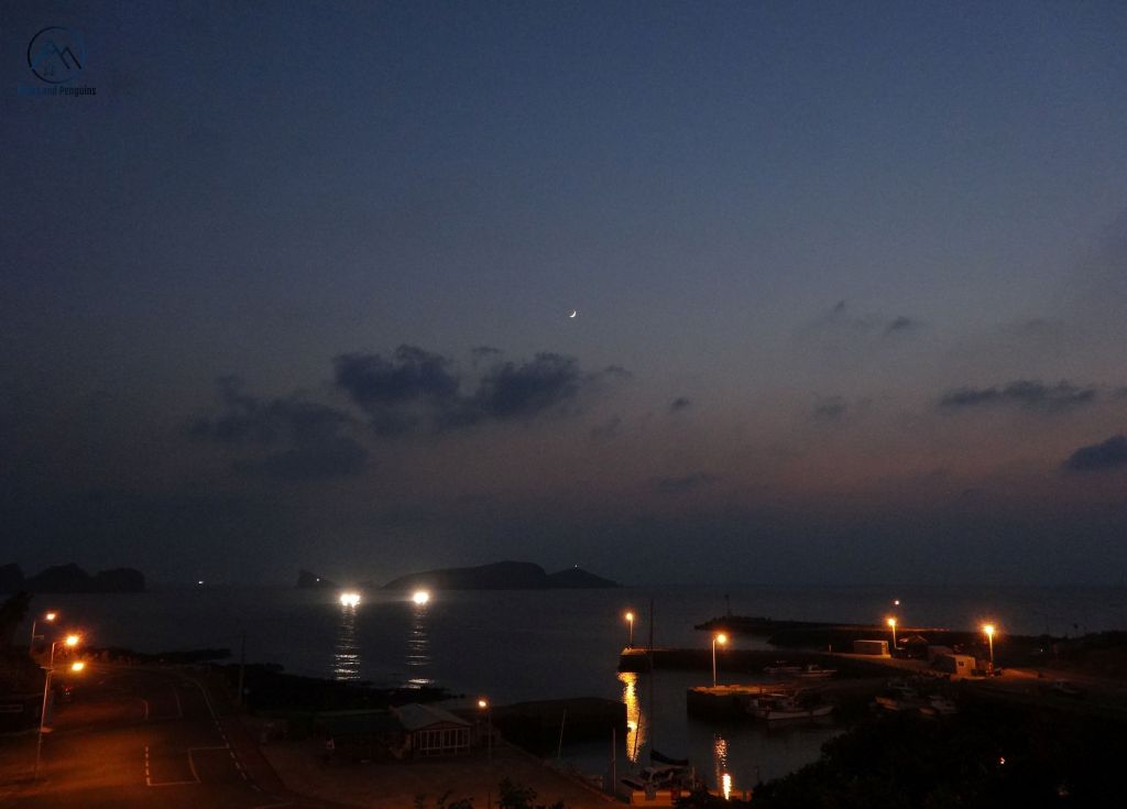
Day 12: 16.2k – Route 20
Route #20 was our last course, and at only 16 kilometers, it promised to be a short day. It was also one of the best days of the trip!
This was the day when we were followed by the sweet dog from our guesthouse! We enjoyed her company for several hours and a surprising number of kilometers. To get her home safely, we stopped at another of the lovely beach towns along the eastern edge of the island. We bought our cute canine friend some sausages from a mart, and poured handfuls of water into our cupped hands for her to drink. We asked an employee for help with our funny (furry) predicament. Together, we waited with her while an official drove over with a van and a pet carrier. But our little friend was much too independent to submit to the indignity of this, and instead sat on the driver’s lap; looking like a little queen regarding her kingdom as they pulled away and out of our view.

With the rest of the course, we took our time: enjoying the windy weather and our last views of volcanic rocks stacked up to make fences, with aromatic ripe tangerines peeking over the top. We lingered on beaches, kicking off our shoes and wading and taking too many photos. Then, at the place where we started the clean-up 12 days earlier, we finished our Jeju Olle circumambulation of 336 kilometers!


We celebrated with some sandwiches and stretches, as we do! Afterwards, we caught a bus bound for Jeju city. We had hoped to catch a ferry to the remote Chujado to complete a bonus quest on Olle routes 18-1 and 2. Alas, due to strong winds, that ferry was cancelled. So we wound up instead on a ferry bound for home, bidding Jeju (and our friends) goodbye.
Although this was the end of our circumambulation, it was not the end of our adventures on Jeju! We did ultimately make it to Chujado for one epic run adventure on Olle courses #18-1 and 18-2. Later, we returned to Jeju to trek that missing section of the circle, course #10, and ride our bikes around the island. Finally, in October 2017, we returned to Jeju again to do our most epic adventure on Jeju thus far: running a one hundred kilometer race!
Know and Go! Jeju Olle
Transportation
Transportation around the island is great (and cheap!) on public buses, but some knowledge of the Korean alphabet can be helpful to know what bus to take and where to get off. For slightly more money, taxis can get you exactly where you want to go, fast! Rental cars and scooters are also available, but obviously less practical if your main mission is trekking around the island.
Trek
The walking itself can be as strenuous or relaxed as you choose, because there are so many options for eating and sleeping. You can choose to complete one course a day or set a more aggressive pace, knowing that you’ll have little trouble finding a stopover/resupply point.
Another important thing to note is wear appropriate shoes! While the Olle network isn’t a mountain hike, it still traverses a variety of terrain types, so you’ll want good footwear. But if you’re signing yourself up for a trek, you probably already know that!
Stay & Eat
Anyone can do this trip. Since Jeju is a popular tourist destination, there are lots of places to stay and there are lots of towns with cafes and restaurants. Foodies often really enjoy sampling the strong flavors of Korean cuisine, but veggies should be aware that Korean cuisine is heavily meat-based. Here on the island, that is especially true, with most dishes featuring seafood in some form. That being said, there are normal grocery stores in both cities and several smaller towns where you can get your own supplies, as we did. Camping can be done (though there are few official campgrounds), and some types of accommodation (pensions especially) have a kitchen available.
Communicate
In urban areas, it’s not difficult to find someone who speaks a little English, but in rural areas, knowing a little Korean or using a dictionary can be really helpful for advanced requests. For example, knowing the Hangul for the various types of accommodation is immensely helpful, as is knowing how to pronounce a food you’d like. But never underestimate the power of charades!
Climate
Although we experienced great weather during our trek, Jeju is famous for its wild winds, so bringing warm clothes is advisable. In general, most hikers head out during Korea’s autumn – for clear skies, pretty foliage and mild weather. But it does tend to rain in fall, especially on Jeju, so pack your rain gear as well. Spring is gorgeous for flowers, but haze can limit visibility. Jeju, being so far south, is also an option in winter. It has relatively mild winters with snowfall being limited to the volcano. Summer is hot, humid and often rainy, but incredibly lush and beautiful. A hike during this season would give you the chance to really enjoy the beaches.
Other notes
Be aware that there are more than the 21 main routes encircling the island to check out! There are also 6 supplementary courses. Four of these are on Jeju’s offshore islands and the other two head to points inland. I would like to highly recommend a loop of courses 18-1 and 18-2 on Chuja Island. This was an awesome, off-the-beaten-path adventure that my husband and I both adored! Other favorite courses on the mainland included routes 8, 9, 11 and 18.
Of course, a trip to Jeju isn’t complete without a visit to Hallasan, the inactive volcano at the center of the island. Additionally, there is an amazing 80 kilometer hiking course around Hallasan. Entirely made of rugged trails and seldom-used forest roads deep in the forest, so it offers a totally different hiking (or trail running!) experience to the Jeju Olle.
Prefer cycling to trekking? Jeju’s got great cycling too – you can bike around the island in just over 200k on a protected bike lane that follows the coastal ring road.
Finally, you might also want to check out some of Jeju’s beaches at greater length or explore the island’s underground lava tubes. Jeju is one of UNESCO’s new natural wonders of the world, so it’s worth extending your trip to explore. Enjoy your adventures there with a box of delicious local tangerines – or tangerine rice wine!
Get maps and more info on the Jeju Olle here or check out Olle community events here.